WALKING THE LAND: ENERGY HUB EXAMPLE – MACHU PICCHU
Last week, I revealed the formula to find an energy hub anywhere in the world.
Here it is again:
Mountain(s) + Water + Earthquake fault line/fissure + Sacred Geometric Shape (triangle, circle, etc.)
Machu Picchu, the sacred Incan global energy hub in Peru, is an excellent example. Sometimes, energy hubs are found with this formula near one another—such as Machu Picchu. Other times, there could be hundreds or thousands of miles between them. Energy lines are categorized as local, regional or global, above-ground, underground, above land, below an ocean.
There are three loaf-like lava mountains closely grouped together. You have a TRIANGLE, one of the sacred geometric designs, shared between them. You also have the fact that they are MOUNTAINS—so you have two of the four parts of the formula in place:
Three mountains
Triangle between the mountains
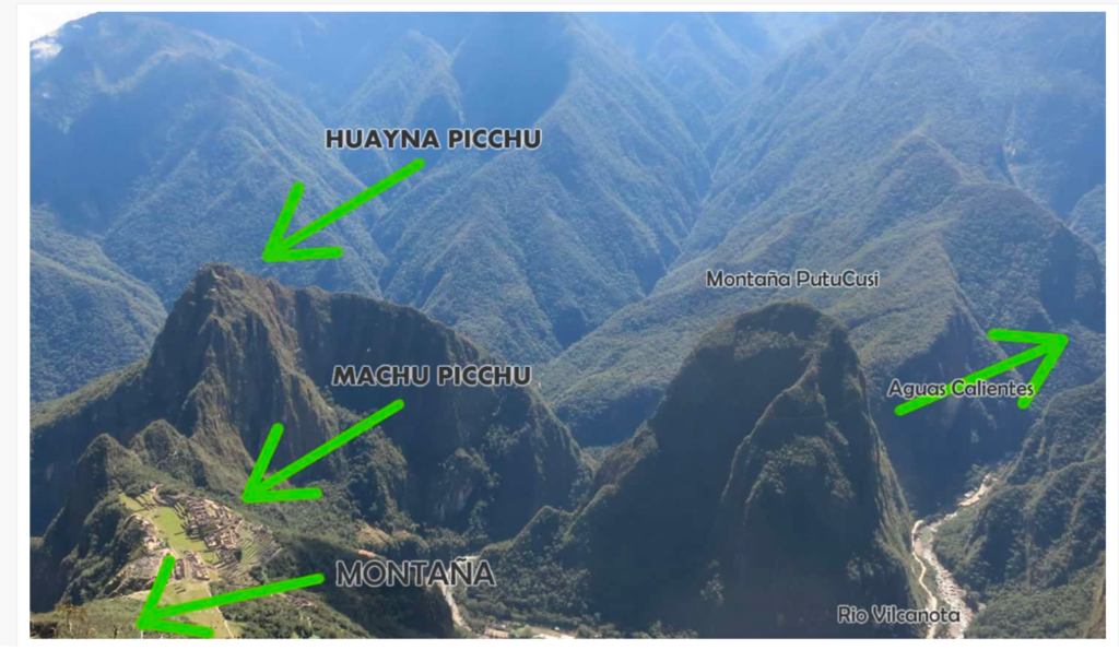
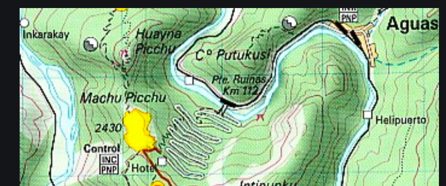
The water is the Urubamba River which snakes past Huynu Picchu (Young Mountain), flows past Machu Picchu (Old Mountain) and curves around Mama Putukusi. Look at this map and you’ll see that the river looks like a large anaconda snake slithering between this triangle of mountains:
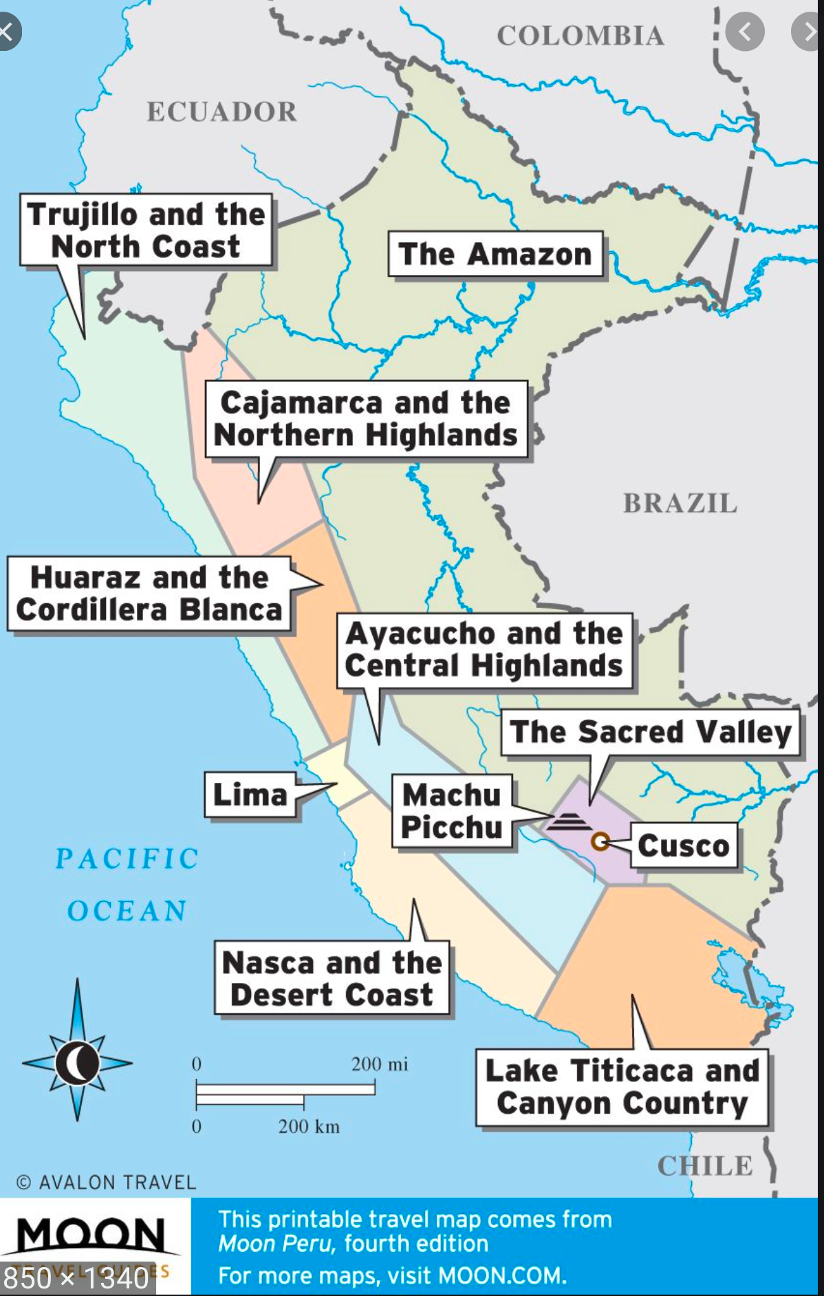
To get a better idea of where this energy hub is located, here’s a very good map of Peru:
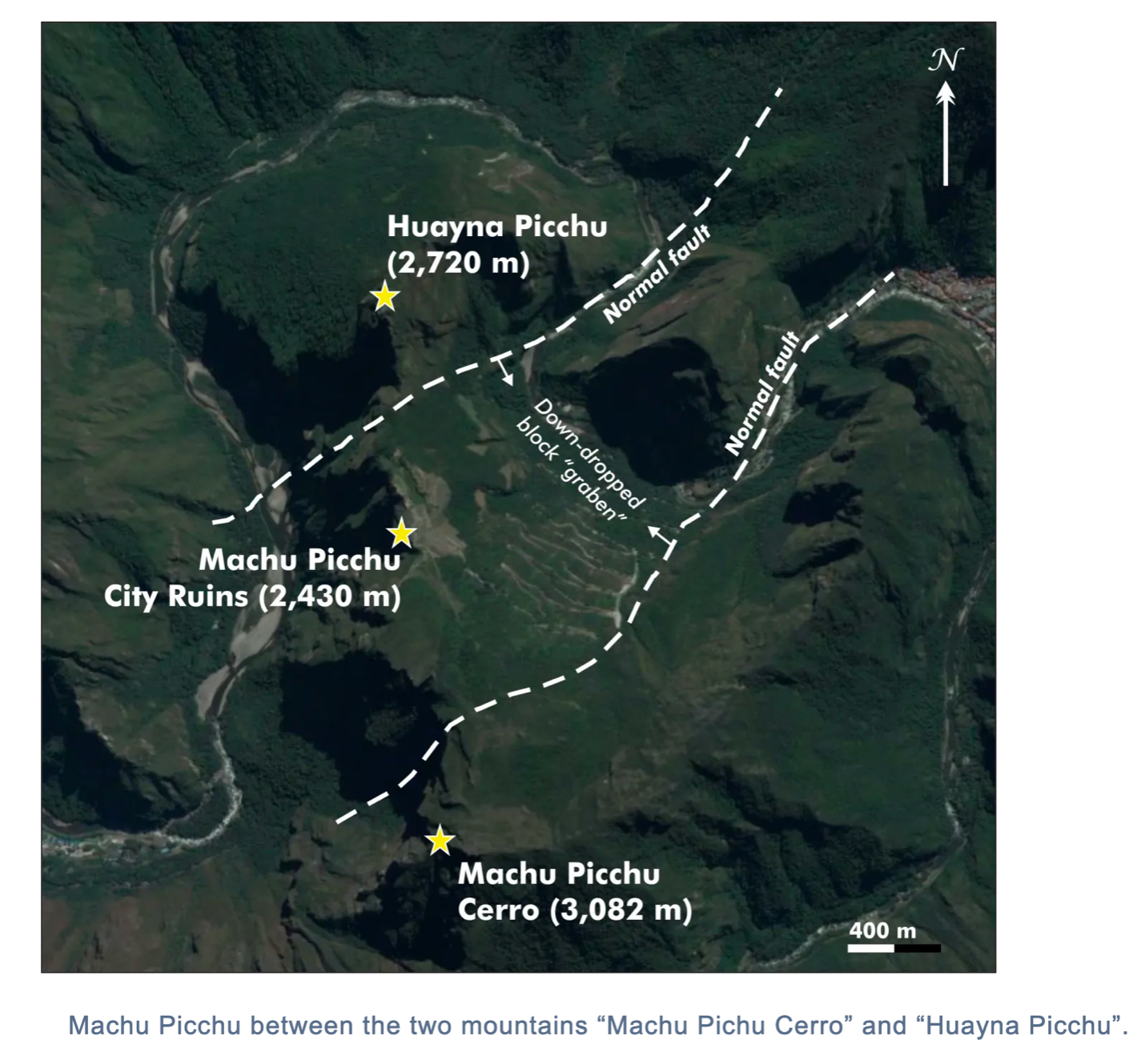
And here is a nice map of the complex itself:
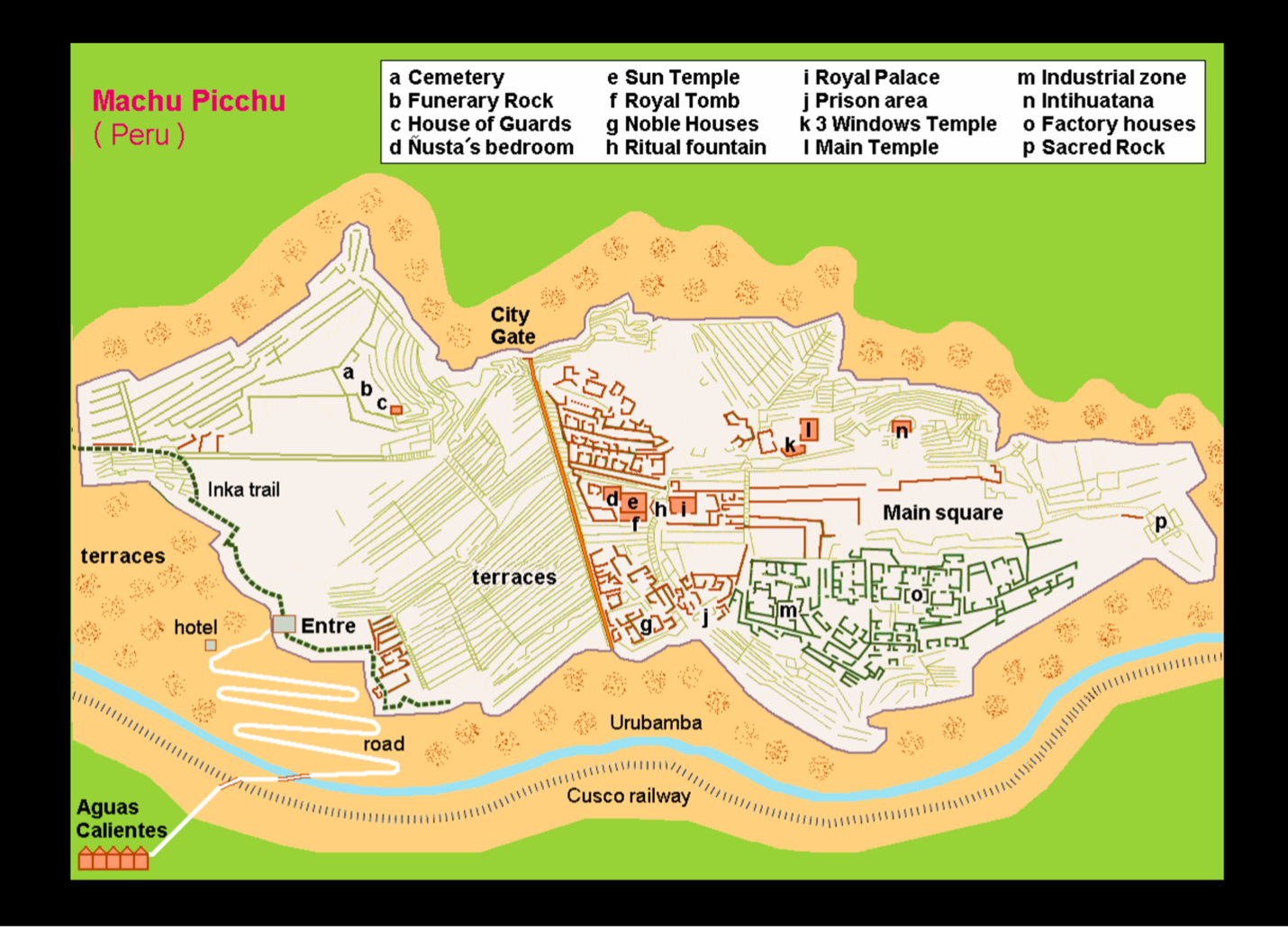
You can see the blue line below the complex is the Urubamba river.
The next piece of the formula, EARTHQUAKE FAULT LINE/FISSURE, must be in place. Right outside of Aguas Calientes (lower left corner of this map) is a hot spring at the top of the hill from this small tourist town.Volcanic activity and earthquakes are very, very active in this area. In 1450 AD, there was a major 6.5 magnitude earthquake when Emperor Pachacuti was building this temple complex. There are two fault lines between Huynu Picchu and Machu Picchu in this diagram. You can also see the WATER, the Urubamba River with the two faults intersecting it, as well. Remember, a fault line(s) or fissure created by an earthquake (ancient or modern), is a cut in the body of our planet. When this happens, there is wild, chaotic, untamed energy released. This requires a mountain (or mountains) to take it from a state of destabilization to stabilization, by placing this energy “online” by that mountain and sending that eruption of energy to another mountain or range so it can become part of the global network of energy. When this occurs, the planet remains stable.
For an in-depth article on fault lines, go here
To sum this up, we have the four pieces of a global (and regional) energy hub that has been created by the geology of area.
Mountains (3)
Water: Urubamba River
Earthquake: 1450 AD, plus two fault lines that run between Huynu Picchu and Machu Picchu
Sacred Geometry: Triangle
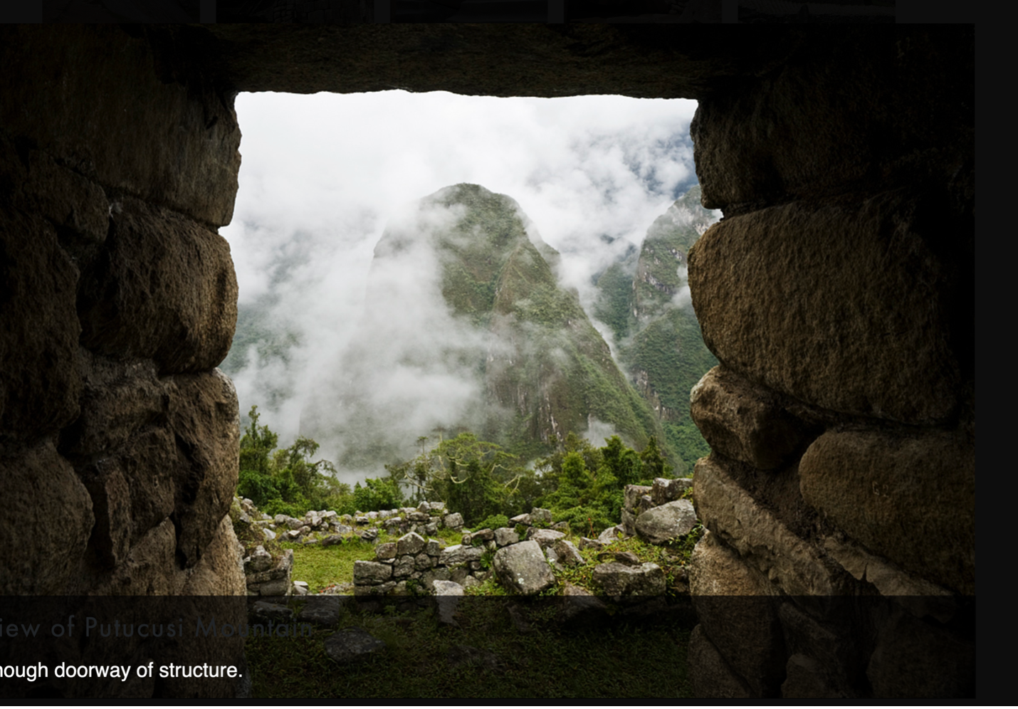
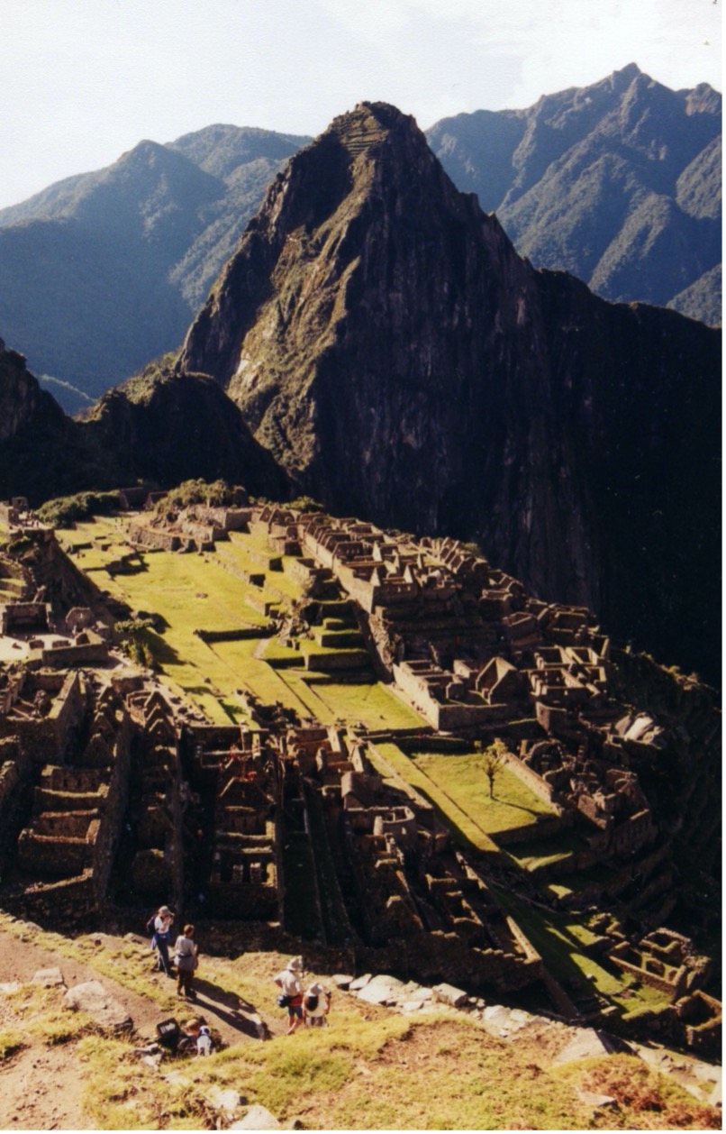
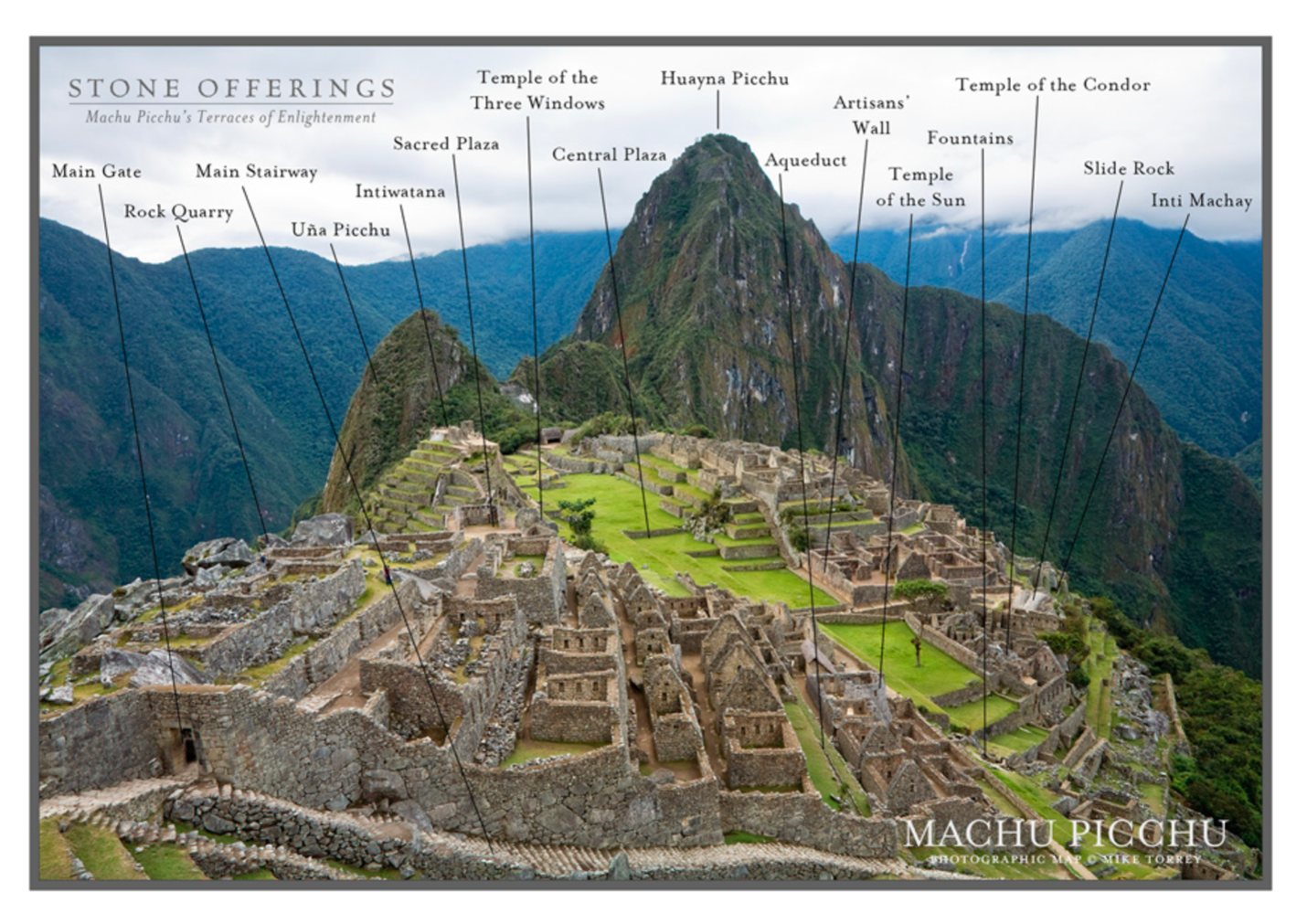
Here is Machu Picchu where the complex was built. In the distance is the second mountain, Huynu Picchu. Below is a very nice photo of Mama Putukusi, the 3rd mountain.
Mama Putukusi as seen through a temple window on Machu Picchu.
